 |
 |
|
|
|
 |
|
|
|
|
|
|
Complete Virtual
Tour 2
Om
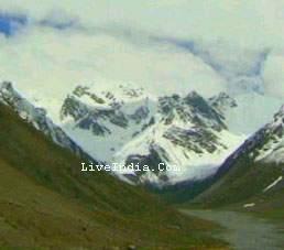
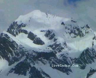
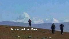
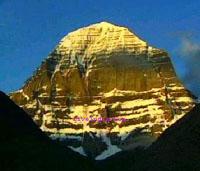
Parvat (or Adi Kailash, or Chhota Kailash, or Baba Kailash, or Jonglingkong)
is an ancient holy Hindu Himalayan mountain peak at an altitude of 6191
m. It's part of the Himalayan Range lying in the Pithoragarh district of
Uttaranchal, India near Sinla pass, similar to Mount Kailash in Tibet.
The snow deposition pattern gives the impression of 'AUM' written over it, which is a sacred Hindu Mantra or chant. Beautiful 'Parvati lake' and 'Jonglingkong lake' are situated near Om Parvat. The Jonglingkong lake is sacred like Mansarovar to the Hindus.
The opposite to this peak there is a mountain called Parwati Muhar, and snow over it shines like crown in sunlight. This peak was climbed for the first time by an Indo-British team including Martin Moran, T. Rankin, M. Singh, S. Ward, A. Williams and R. Ausden. Climbers did not climb above 6,000 M, due to sacred nature of the peak!
|
||
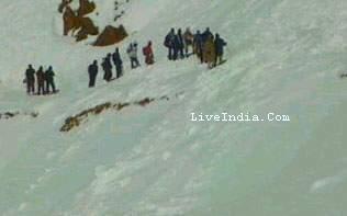
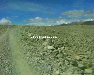
From Om Parbat people cross Lipu daraa which is around 18 kilometer |
||
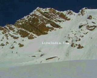
Lipu daraa is crossed at night from where we will enter in china |
||
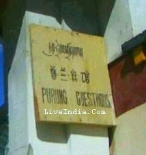
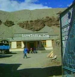
In China Breakfast & stay is done at Purung Guest House |
||
|
||
|
Click for Next Page Complete Virtual Tour |
| Day 1. Delhi - Kathgodam.
Train from Delhi at night will reach Kathgodam in the morning.
Day 2. Kathgodam - Pitthoragarh: This is a long travel by road along the curving mountain roads. Pitthorgarh is district headquaters, and has some amazing places. Kumaon Mandal Vikas Nigam has their resthouse at the foot of Chandok hills. From Chandok hills one can get amazing view of the hills and the city. Day 3. Pitthoragarh - Dharchula - Tawaghat: One has to procure inner line permits from District Magistrate office at Dharchula against character certificate or passport. The office is closed on Sunday, so plan accordingly. Jeep could be taken from Dharchula to Tawaghat. One can reach further ahead of Tawaghat till the base of Gala, with the road developed. Else one climb the climb of Thanedar (Thanedar ki Chadai) to reach Pangu. Day 4: Pangu-Narayan Ashram: An architecture masterpiece amongst some good gardens and thrilling mountain views is Narayan Ashram. Guests are welcomed at Narayan Ashram and small group can find accomodation and food. Day 5: Narayan Ashram to Sirkha: Route taking through small mountain villages. One can further go ahead and camp at Samry at the base of Rungling Top. Day 6: Sirkha - Gala: Gala is the first camp for Greater Kailash trip. From Shirkha one climbs the densely forested Rungling top to reach Gala. Forest house Junglechatti is located on the route. Day 7: Gala to Budhi: A long descent and then gentle climb would lead you to this beautiful village. Malpa is the place where entire village was vanished in a landslide few years back. PWD guesthouse is the only place left here. Day 8: Buddhi to Gunji: From Buddhi one has to climb the Chiyalekh top. This would be the first time where your inner line permits would be checked by Indo-Tibet Border Police(ITBP). Chiyalekh top is an excellent plateau with snowclad mountains surrounding on two sides with green pastures. This would be first time the altitude increases above 8000 feet. Gunji is at 10625 feet. Acclimatization at Gunji would be needed. Day 9: Gunji to Kalapani: As altitude increase, one can slowly proceed to Kalapani, place where Kali river is said to originate. Kalapani is at the same altitude as Gunji around 11850 feet. Day 10: Kalapani to Nabidhang: This is the last camp at the border of India-China border and one can camp near ITBP camp. From Nabidhang(13800 feet) one get view of Om Parvat, mountain with Hindu letter Om appearing distinctly on the mountain. For this you must be blessed by mother Nature for clear weather, else one may add a spare day here to take chances with clear weather. Day 10: Nabidhang to Gunji: Descent could be done much faster and one can reach directly to Gunji. Day 11: Gunji to Kutti: Kutti (11880 feet) is the last village on this route along the border. This place has some links with Mahabharat, and Pandav brothers were said to have stayed here. The place is named after name of their mother Kunti. Day 12-13: Kutti to Jollingkong: A long ascent would lead you to Jollingkong(15550 feet). This place is ITBP cmp with KMVN rest house. Here you get view of Adi Kailash mountain and Parvati Sarovar (lake). One can camp here for additional day to acclimatize before crossing the Sinla pass. Day 14: Jollingkong -Bidang: The climb would start very early in the morning to cross the pass by morning. The pass is at altitude of 18500 feet and is often a technical climb when the season had experienced heavy snowfall. ITBP inspects the route before allowing anyone to cross the route. While descent to Bidang(14500 feet) is very steep with rock falling most of the time. Care, preperation is must for crossing the pass. If one doesnt cross the pass, one has to trace the path back and reach Tawaghat within 4-5 days avoiding Narayan Ashram. Day 15: Bidang to Baun: This valley is less inhabitated and one has to camp at almost all places. Day 16: Baun -Duktu-Son-Balling Day 17: Balling- Nagling-Sela-Baulling Day 18: Baulling-Sobala-Tawaghat Day 19: Tawaghat-Dharchula-Pitthoragarh Day 20: Rest Day 21: Pitthoragah - Nanital Day 22: Nanital - Kathgodam - Delhi |

|
|
|
|
|
|
Welcome to Swami Rajesh Chopra's |
 |
 |
|
All rights reserved. No part of this publication and other sites of under liveindia.com may be transmitted or reproduced in any form or by any means without prior permission from the publisher Live India Internet Services or Rajesh Chopra. |