Ladakh is highest plateau
of Indian held Kashmir with much of it being over 3,000 m (9,800 ft). It
spans the Himalayan and Karakoram mountain ranges and the upper Indus River
valley. Historical Ladakh includes the fairly populous main Indus valley,
the more remote Zangskar (in the south) and Nubra valleys (to the north
over Khardung La), the almost deserted Aksai Chin, and Kargil and Suru
Valley areas to the west (Kargil being the second most important town in
Ladakh). Before partition, Baltistan (now under Pakistani administration)
was a district in Ladakh. Skardu was the winter capital of Ladakh while
Leh was the summer capital.
The mountain ranges in this
region were formed over a period of 45 million years by the folding of
the Indian plate into the more stationary Eurasian Plate. The drift continues,
causing frequent earthquakes in the Himalayan region.] The peaks in the
Ladakh range are at a medium altitude close to the Zoji-la (5,0005,500
m or 16,00018,050 ft), and increase towards south-east, reaching a climax
in the twin summits of Nun-Kun (7000 m or 23,000 ft).
Ladakh is a land like no
other. Bounded by two of the world's mightiest mountain ranges, the Great
Himalaya and the Karakoram, it lies athwart two other, the Ladakh range
and the Zanskar range.
In geological terms, this
is a young land, formed only a few million years ago by the buckling and
folding of the earth's crust as the Indian sub-continent pushed with irresistible
force against the immovable mass of Asia. Its basic contours, uplifted
by these unimaginable tectonic movements, have been modified over the millennia
by the opposite process of erosion, sculpted into the form we see today
by wind and water.
Yes, water! Today, a high -altitude
desert, sheltered from the rain-bearing clouds of the Indian monsoon by
the barrier of the Great Himalaya, Ladakh was once covered by an extensive
lake system, the vestiges of which still exist on its south -east plateaux
of Rupshu and Chushul - in drainage basins with evocative names like Tso-moriri,
Tsokar, and grandest of all, Pangong-tso. Occasionally, some stray monsoon
clouds do find their way over the Himalaya, and lately this seems to be
happening with increasing frequency. But the main source of water remains
the winter snowfall. Drass, Zanskar and the Suru Valley on the Himalaya's
northern flank receive heavy snow in winter; this feeds the glaciers whose
meltwater, carried down by streams, irrigates the fields in summer. For
the rest of the region, the snow on the peaks is virtually the only source
of water. As the crops grow, the villagers pray not for rain, but for sun
to melt the glaciers and liberate their water. Usually their prayers are
answered, for the skies are clear and the sun shines for over 300 days
in the year.
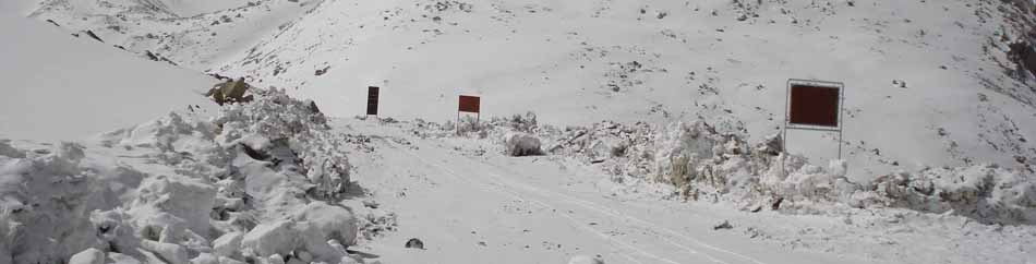
Ladakh lies at altitudes
ranging from about 9,000 feet (2750m) at Kargil to 25,170 feet (7,672m)
at Saser Kangri in the Karakoram. Thus summer temperatures rarely exceed
about 27 degree celcius in the shade, while in winter they may plummet
to minus 20 degree celcius even in Leh. Surprisingly, though, the thin
air makes the heat of the sun even more intense than at lower altitudes;
it is said that only in Ladakh can a man sitting in the sun with his feet
in the shade suffer from sunstroke and frostbite at the same time!
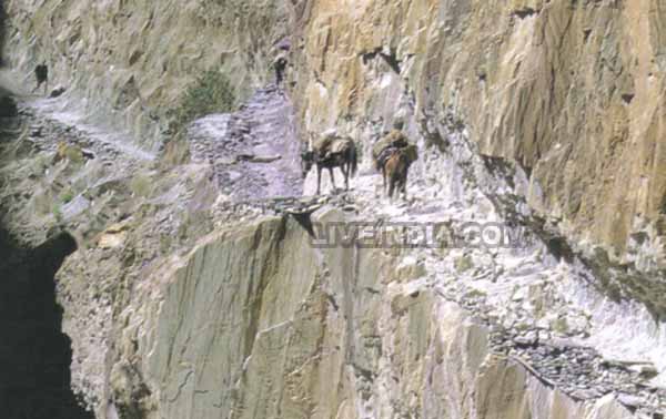
The Suru and Zangskar valleys
form a great trough enclosed by the Himalayas and the Zangskar range. Rangdum
is the highest inhabited region in the Suru valley, after which the valley
rises to 4,400 m (14,436 ft) at Pensi-la, the gateway to Zangskar. Kargil,
the only town in the Suru valley, was an important staging post on the
routes of the trade caravans before 1947, being more or less equidistant,
at about 230 kilometres from Srinagar, Leh, Skardu, and Padum. The Zangskar
valley lies in the troughs of the Stod and the Lungnak rivers. The region
experiences heavy snowfall; the Pensi-la is open only between June and
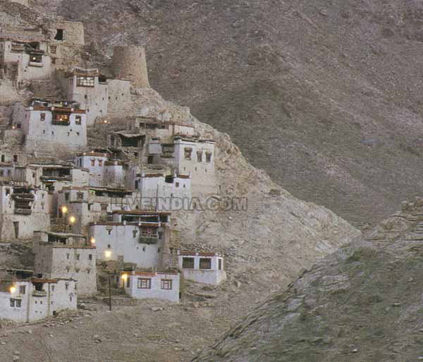
mid-October. The Indus river is the backbone of Ladakh. All major historical
and current towns Shey, Leh, Basgo, and Tingmosgang, are situated close
to the river