 |
Leh Ladakh With Gallery |
 |
|
Leh Ladakh With Gallery |
|
|
|
|
|
|
|
|
|
|
|
|
|
|
|
|
|
|
|
|
|
 |
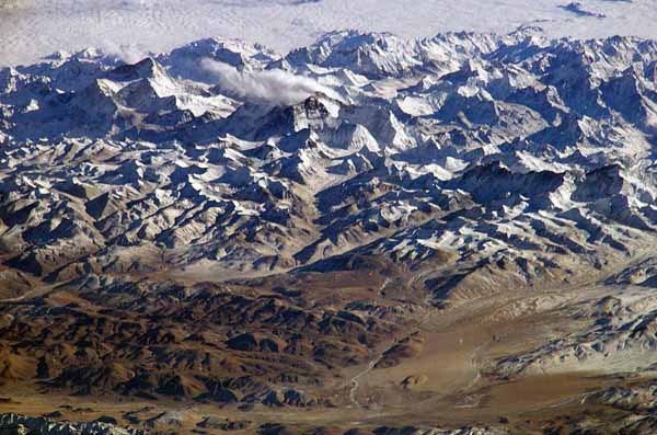
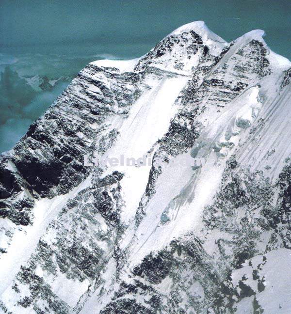
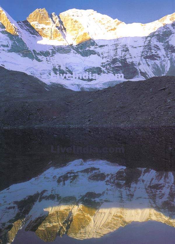
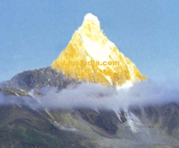
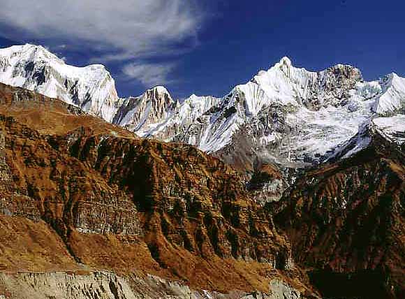
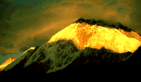
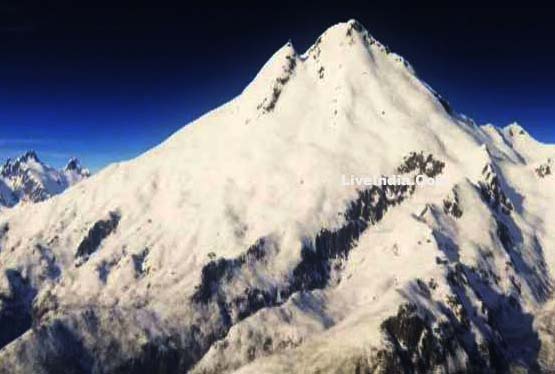
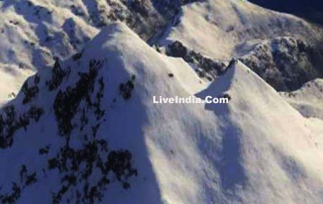
Himalaya
The 6,000-km-plus journey of the India landmass (Indian Plate) before its collision with Asia (Eurasian Plate) about 40 to 50 million years ago (see text). India was once situated well south of the Equator, near the continent of Australia. The Himalayas and the Tibetan
Plateau to the north have risen very rapidly. In just 50 million years,
peaks such as Mt. Everest have risen to heights of more than 9 km. The
impinging of the two landmasses has yet to end. The Himalayas continue
to rise more than 1 cm a year -- a growth rate of 10 km in a million years!
If that is so, why aren't the Himalayas even higher? Scientists believe
that the Eurasian Plate may now be stretching out rather than thrusting
up, and such stretching would result in some subsidence due to gravity
Fifty kilometers north of Lhasa (the capital of Tibet), scientists found layers of pink sandstone containing grains of magnetic minerals (magnetite) that have recorded the pattern of the Earth's flip-flopping magnetic field. These sandstones also contain plant and animal fossils that were deposited when the Tethys Sea periodically flooded the region. The study of these fossils has revealed not only their geologic age but also the type of environment and climate in which they formed. For example, such studies indicate that the fossils lived under a relatively mild, wet environment about 105 million years ago, when Tibet was closer to the equator. Today, Tibet's climate is much more arid, reflecting the region's uplift and northward shift of nearly 2,000 km. Fossils found in the sandstone layers offer dramatic evidence of the climate change in the Tibetan region due to plate movement over the past 100 million years. At present, the movement of India continues to put enormous pressure on the Asian continent, and Tibet in turn presses on the landmass to the north that is hemming it in. The net effect of plate-tectonics forces acting on this geologically complicated region is to squeeze parts of Asia eastward toward the Pacific Ocean. One serious consequence of these processes is a deadly "domino" effect: tremendous stresses build up within the Earth's crust, which are relieved periodically by earthquakes along the numerous faults that scar the landscape. Some of the world's most destructive earthquakes in history are related to continuing tectonic processes that began some 50 million years ago when the Indian and Eurasian continents first met.
|
|||
|
|||
 |
|||
 |
|||
 |
|||
 |
|||
 |
|||
 |
|||
 |
|||
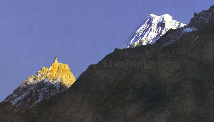
The Himalaya is a mountain range in Asia, separating the Indian subcontinent from the Tibetan Plateau. By extension, it is also the name of the massive mountain system which includes the Himalaya proper, the Karakoram, the Hindu Kush, and a host of minor ranges extending from the Pamir Knot. The name is from Sanskrit himalaya, a tatpurusa compound meaning "the abode of snow" (from hima "snow", and alaya "abode"; see also Himavat). |
|||
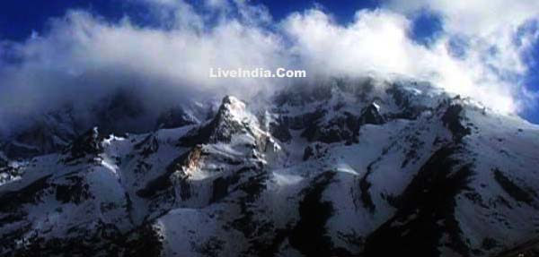
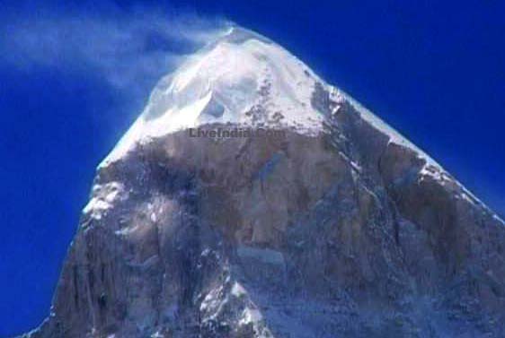
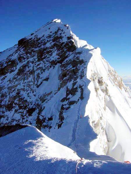
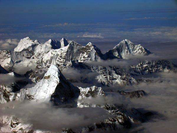
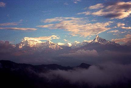
Together, the Himalaya mountain system is the planet's highest and home to all fourteen of the world's highest peaks: the Eight-thousanders, including Mount Everest. To comprehend the enormous scale of Himalaya peaks, consider that Aconcagua, in the Andes, at 6,962 m, is the highest peak outside the Himalaya, while the Himalaya system has over 100 separate mountains exceeding 7,200 m. |
|||
The Himalaya stretches across five nations: Bhutan, China, India, Nepal, and Pakistan. It is the source of three of the world's major river systems, the Indus Basin, the Ganga-Brahmaputra Basin and the Yangtze Basin. An estimated 750 million people live in the watershed area of the Himalayan rivers, which also includes Bangladesh |
|||
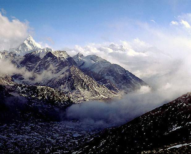
The Indian Himalayas The arc-shaped Himalayas extend along the entire northern boundary of India and carve just as far across the Indian subcontinent as they do deeply into the life around them. The term "Himalaya" -- a Sanskrit word meaning "the Abode of Snow" -- was coined by the Indian pilgrims who traveled in these mountains in ancient times. For centuries, the inhabitants of India have been fascinated by this mountain chain. The feeling is a mixture of admiration, awe and fear; and for the Hindus of India, the Himalayas are also "the Abode of God". There are numerous pilgrim routes that have brought the Hindu pilgrims to these mountains since time immemorial. The Indian Himalayas cover a vast area along the northern frontiers of the country and span five Indian States -- Jammu and Kashmir , Himachal Pradesh, Uttar Pradesh, Sikkim and Arunachal Pradesh -- from west to east. For the mountain people living in these states, the Himalayas continue to be the predominant factor in their lives. Having acted as a natural and political barrier for centuries, the Himalayas have isolated a number of communities, cultures and customs. |
|||
The Indian Himalayas mark the crossroads of Asia's three main religions. Kashmir -- formerly a paradise on earth -- is largely influenced by Islam. The foothills of Jammu, Himachal Pradesh and Uttar Pradesh form the northern boundary of Hinduism. The entire Trans Himalayan region, from Ladakh (Jammu and Kashmir) through Tibet and onto the eastern state of Sikkim, has seen a dominating influence of Buddhism. |
|||
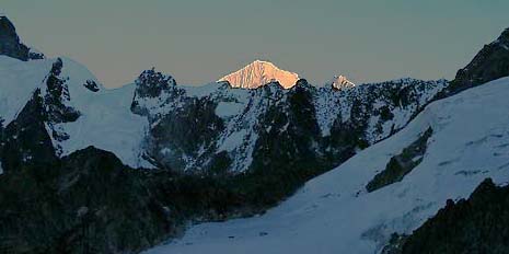
Nepal Himalayas General info Containing nine of the world's fourteen highest mountain peaks, Nepal is a true Himalayan kingdom. The Himalayas cover three fourths of the land in Nepal. It is home to some of the highest, remotest, most rugged and most difficult terrain in the world. The loftiest peak in the world -- Mount Everest -- and other high peaks like Lhotse, Nuptse, Annapurna, Dhaulagiri and Manaslu, plus the presence of some exquisitely beautiful trekking routes, attract hundreds of thousands of people from all over the world to this lovely Himalayan destination. The country of Nepal can be divided into three parallel bands running from the northeast towards the southwest. Along the north of Nepal runs the Great Himalayan Range, the highest mountain range in the Himalayan system. This range has an average altitude of about 4,570 m (about 15,000 ft) and remains perpetually snow-covered. On this range rise some of the loftiest mountain peaks in the world -- Mount Everest, Kanchenjunga, Lhotse, Makalu, Cho Oyu, Dhaulagiri, Manaslu, and Annapurna. |
|||
Further south runs a complex system of intermediate ranges at an altitude of 8,000-14,000 ft. Prominent ranges in this mountain system include the Mahabharat and Churia ranges. High mountain ranges are interspersed with broad inhabited river valleys. The third and southernmost region is the Terai, a swampy terrain which is the northern extension of the Indian plains. |
|||
|
|
|
|
|
|
|
( The Trade Marks Act, 1999, No. 01403086. User Since : 01/04/1997 ) All rights reserved. No part of this publication and other sites of under liveindia.com may be transmitted or reproduced in any form or by any means without prior permission from the publisher Live India Internet Services or Mr.Rajesh Chopra, L.C.Premium Cables, 1826, Amar Nath 2nd Building, Bhagirath Palace Delhi - 110006, India. Liveindia.com or Mr.Rajesh Chopra is not responsible for any wrong information under live india's sites, For confirmation of any information it is recommended that you reconfirm it from your end. |
 |
 |
 |
 |
 |
 |
 |
 |
 |
 |
 |
| Himalaya - Himalaya Photos- Gallery - Himalaya Info - Himalaya Tours |